A three-million-hectare project: Remote sensing Northern Lapland
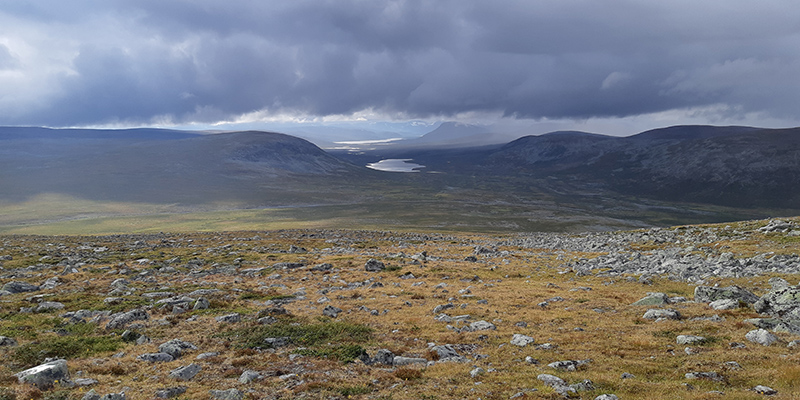
According to the results of the project “Remote sensing the habitats of Northern Lapland”, the current situation of more than half of the mountain birch forests and treeless mountain heaths has weakened to varying degrees. This worrisome situation has come to light in the final report of the collaborative project between National Parks Finland and the Finnish Environment Institute (Syke). The project surveyed nearly three million hectares of Northern Lapland’s nature conservation and wilderness areas in 2020–2023.
Metsähallitus, Parks & Wildlife Finland manages 85% of the fell areas, i.e. 1.5 million hectares. It includes almost all the vast wilderness areas of Lapland, the national parks of Pallas–Yllästunturi, Urho Kekkonen and Lemmenjoki as well as the strict nature reserves of Kevo and Malla.
It is difficult to protect nature if you don’t know what is in there and how it changes over time. Up-to-date information on nature is also the basis for the sustainable use of all natural resources.
More than a third of fell habitats in Finland are endangered. The main causes for their endangerment are climate change and intense reindeer grazing and their combined effects. The consequences of climate change include a decline in the number of mountain birch forests as the damage caused by geometrid moths increases, increase of coniferous forests in lower slopes of the fells, reverting to brush, and melting of palsa mounds. Reindeer grazing is part of the fell nature; however, intense grazing pressure weakens the state of dry, lichen-filled fell habitats and dry and dryish mountain birch habitats in particular. In some fell areas, information on nature is inadequate, so the situation may be even worse than estimated and we will not be able to monitor the future change.
Remote sensing to the rescue
Various land use pressures have also increased in the North. As the steward of Natura areas in state-owned land, Metsähallitus, Parks & Wildlife Finland has a major responsibility for maintaining a favourable conservation status of natural habitats in Finland. How to collect reliable nature information from such large areas?
The latest remote sensing methods are needed for mapping and monitoring the areas. Remote sensing materials and their availability, which enable simultaneous monitoring of large areas, have improved in recent years. Methods for interpreting large amounts of data have also improved, thanks to machine learning and other developments.
The objective of the remote sensing project of the nature in Northern Lapland was to update the obsolete biotope data collected in Northern Lapland in 1996–1999, mainly utilising satellite and laser scanning data. The update applies to both nature information and the boundaries of habitats. The total area that included in the remote sensing project is approximately 2.8 million hectares, as it also includes habitats other than fells.
The project developed, tested and introduced the latest remote sensing methods and materials for monitoring habitats. Remote sensing methods are not suitable for the mapping and monitoring of all habitas, so field surveys were also needed. In addition, remote sensing methods require reliable information from the field both to help interpretation and to ensure the quality of the data produced.
Cooperation with the Finnish Environment Institute
The project was carried out in collaboration with the Finnish Environment Institute (SYKE). SYKE has plenty of expertise in remote sensing.
SYKE compiled the necessary source materials for the project, such as the time series of the Sentinel satellite images and the products calculated from them, as well as data produced through laser scanning which describes the vegetation. Based on this data, biotope data will be updated and a new polygon network will be created. The production of a new polygon network will be based on SYKE’s interpretation of remote sensing data. New field data collected by Metsähallitus will support the work. In terms of some habitats, additional research is also carried out so that remote sensing methods can be used to reliably assess how representative their state is and how much they are in their natural state.
Utilising the information
The updated nature information will be stored in the Protected area compartment information system (SAKTI) maintained by Metsähallitus, Parks & Wildlife Finland. There it will be available when preparing the management and use plans for protected areas, evaluations of the status of Natura areas, and various statements and other evaluations. The information is also directly available to SYKE and the Centres for Economic Development, Transport and the Environment through the system. This means that the information can also be easily utilised in, for example, reporting required under the EU Habitats Directive and assessments of endangered habitats.
Project duration and funding
Project duration: 3 years (2020–2022)
Annual budget: € 310,000
Funding: Ministry of the Environment/Government future investments and the Finnish Environment Institute
Contact information
Project Coordinator Anna Tammilehto
Metsähallitus, Parks & Wildlife Finland, Lapland
anna.tammilehto(at)metsa.fi
More information
Last updated 23 September 2024